A Seminar Series covering Topics in Ocean Technology and Marine Sciences
Upcoming Seminars:
- NORCE - Ocean Plastic Research
- Kongsberg - Seafloor Observatories & Underwater Technology
- NPD - Minerals Ressources
- NANSEN - Space Technology for Ocean Studies
Past Seminars:
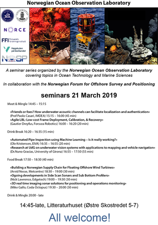
Seminars 21 March 2019
In collaboration with the Norwegian Forum for Offshore Survey and Positioning
In collaboration with the Norwegian Forum for Offshore Survey and Positioning
|
Meet & Mingle 14:45 – 15:15
«Friends or foes? How underwater acoustic channels can facilitate localization and authentication» (Prof Paolo Casari, IMDEA) 15:15 – 16:00 (45 min) «Agile LBL: Low-cost Frame Deployment, Calibration, & Recovery» (Gautier Dreyfus, Forssea Robotics) 16:00 – 16:20 (20 min) Drink Break 16:20 – 16:35 (15 min) «Automated Pipe Inspection using Machine Learning – Is it really working?» (Ole Kristensen, EIVA) 16:35 – 16:55 (20 min) «Research at UdG on underwater vision systems with applications to mapping and vehicle navigation» (Dr.Nuno Gracias, University of Girona) 16:55 – 17:50 (55 min) Food Break 17:50 – 18:30 (40 min) «Building a Norwegian Supply Chain for Floating Offshore Wind Turbines» (Arvid Nesse, Metcentre) 18:30 – 19:00 (30 min) «Ogoing developments in Side Scan Sonars and Sub Bottom Profilers» (Nick Lawrence, Edgetech) 19:00 – 19:30 (30 min) «3D real time imaging sonar solutions for positioning and operations monitoring» (Mike Gallo, Coda Octopus) 19:30 – 20:00 (30 min) Drink & Mingle 20:00 - late |
Flyer
|
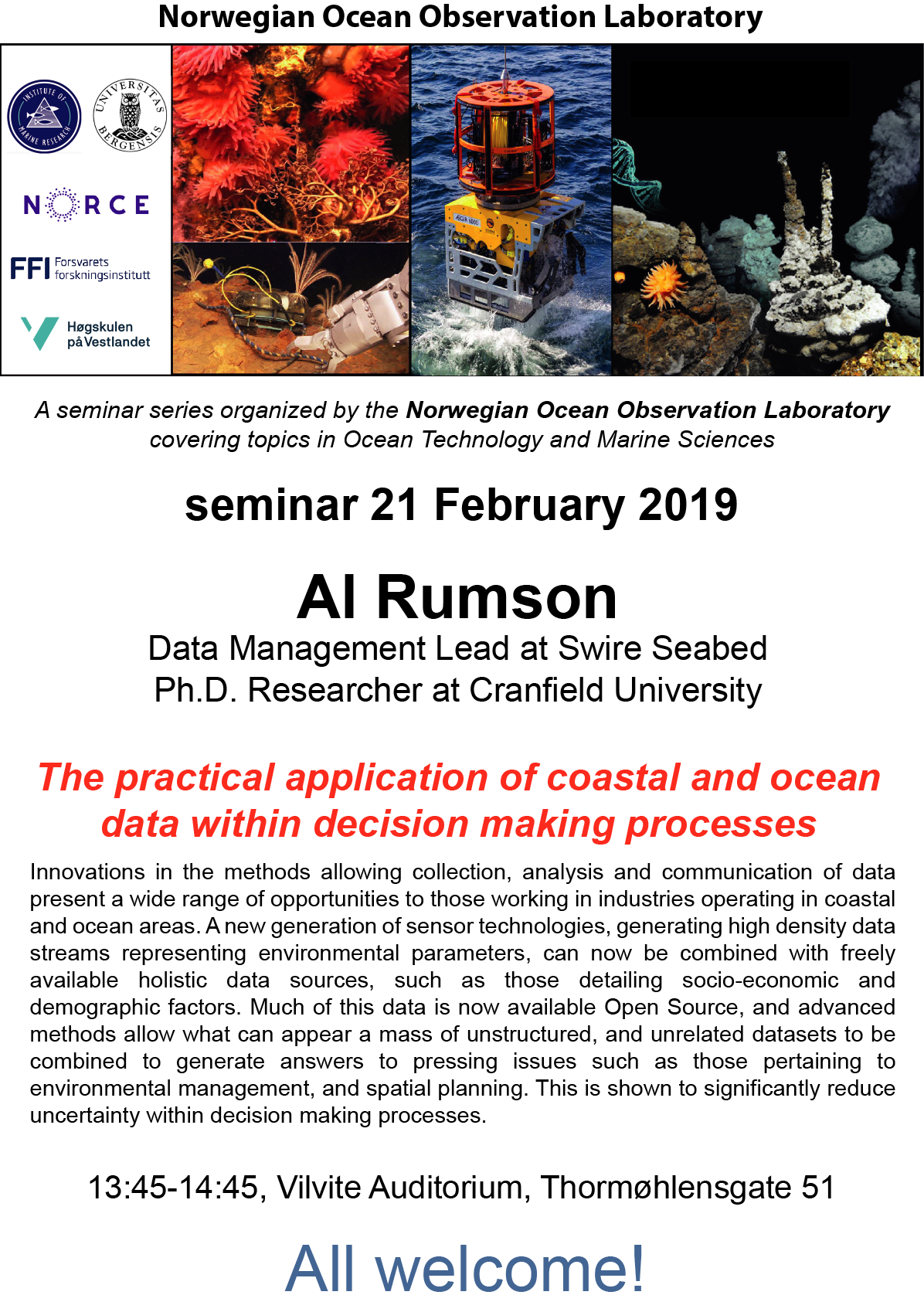
Seminar 21 February 2019
Al Rumson, Swire Seabed, Norway, Cranfield University, UK
Al Rumson, Swire Seabed, Norway, Cranfield University, UK
|
The practical application of coastal and ocean data within decision making processes
Innovations in the methods allowing collection, analysis and communication of data present a wide range of opportunities to those working in industries operating in coastal and ocean areas. A new generation of sensor technologies, generating high density data streams representing environmental parameters, can now be combined with freely available holistic data sources, such as those detailing socio-economic and demographic factors. Much of this data is now available Open Source, and advanced methods allow what can appear a mass of unstructured, and unrelated datasets to be combined to generate answers to pressing issues such as those pertaining to environmental management, and spatial planning. This is shown to significantly reduce uncertainty within decision making processes. |
Flyer
|
Seminar 17 January 2019
Dr. Geir Pedersen, NORCE, Norway
Dr. Geir Pedersen, NORCE, Norway
|
Lofoten–Vesterålen Cabled Ocean Observatory
Real time data from the ocean give fundamental new insight in marine processes including behavioural dynamics of organisms and variation in physical and chemical properties. Such information also enhances understanding of the relationships between physical drivers and biological response, a prerequisite for models that aim at reflecting true dynamics in marine ecosystem. LoVe ocean observatory is a cabled transect of sensor platforms crosses the continental shelf off the ecological hotspot off Vesterålen, Northern Norway. The system simultaneously records both the benthic life and the dominant currents and migration routes of cod, herring and whales. The observatory is also available as a laboratory for the Industry to test new subsea technology and sensors. |

Flyer
|
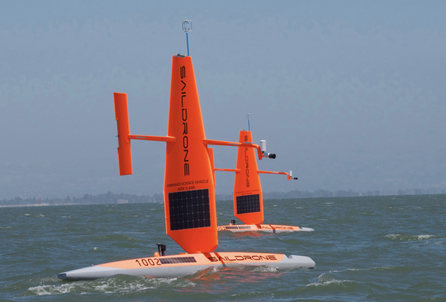
Seminar 13 June 2018
Sebastian de Halleux, Saildrone, USA
Tonny Algrøy, Simrad, Kongsberg Maritime, Norway
Sebastian de Halleux, Saildrone, USA
Tonny Algrøy, Simrad, Kongsberg Maritime, Norway
Saildrone: Unmanned Surface Vehicles for Scientific Research
The oceans affect the fundamental processes that drive our weather and climate. Understanding these processes and how they impact the exchange of energy and mass across the air-sea interface is crucial, but getting reliable and affordable data from remote parts of the ocean has historically been difficult. Saildrone designs and manufactures wind and solar powered unmanned surface vehicles (USVs) which make cost-effective ocean data collection possible at scale. In this talk, Sebastien will detail Saildrone’s capabilities and report on recent missions around the globe, for applications including autonomous fish stock assessment, whale monitoring and marine mammal tracking in the Bering Sea; weather data collection and satellite calibration in the Tropical Pacific; and environmental monitoring of oil seeps and nitrate flows in the Gulf of Mexico. He will also highlight developments including bathymetry and Marine Protected Area surveillance. Sebastien will also give a live demo and discuss potential USV applications in Norway. Also present will be Tonny Algrøy of Simrad / Kongsberg Maritime, who will discuss the new possibilities opened by the successful integration of the Simrad EK80 echosounder on theSaildrone platform.
The oceans affect the fundamental processes that drive our weather and climate. Understanding these processes and how they impact the exchange of energy and mass across the air-sea interface is crucial, but getting reliable and affordable data from remote parts of the ocean has historically been difficult. Saildrone designs and manufactures wind and solar powered unmanned surface vehicles (USVs) which make cost-effective ocean data collection possible at scale. In this talk, Sebastien will detail Saildrone’s capabilities and report on recent missions around the globe, for applications including autonomous fish stock assessment, whale monitoring and marine mammal tracking in the Bering Sea; weather data collection and satellite calibration in the Tropical Pacific; and environmental monitoring of oil seeps and nitrate flows in the Gulf of Mexico. He will also highlight developments including bathymetry and Marine Protected Area surveillance. Sebastien will also give a live demo and discuss potential USV applications in Norway. Also present will be Tonny Algrøy of Simrad / Kongsberg Maritime, who will discuss the new possibilities opened by the successful integration of the Simrad EK80 echosounder on theSaildrone platform.
|
Flyer
|
Seminar 12 April 2018
Dr. Daniel J. Fornari, Woods Hole Oceanographic Institution, USA
Dr. Daniel J. Fornari, Woods Hole Oceanographic Institution, USA
High-Resolution Mapping and Sampling Technologies to Study Deep-Sea Volcanic and Hydrothermal Processes in the 21st Century
The deep oceans and global seafloor are truly Earth’s last frontier. They remain largely unexplored, yet are critical to our survival on this planet. Covering nearly 70% of our planet and reaching depths of greater than 11,000 m, the ocean realm contains the largest chain of active volcanoes, boiling hot springs, and fault zones. In undersea mountains a mile beneath the surface, bizarre landscapes host exotic life forms that rival the most imaginative science fiction. In this dark and largely unexplored environment the potential exists for profound scientific discoveries in this century that will likely shape the future of human society. Despite the opaque blue mask of the oceans as depicted on many maps, the Earth’s solid crust extends continuously beneath the oceans with distinctive geological processes, spectacular landforms, and strange life, much of it still unknown. Whereas the continents above the sea are easily observable, light does not penetrate the ocean depths below ~400 m, hence imaging and exploring the vast seafloor environment presents special challenges. Over the past few decades, using specially developed technologies including autonomous robots, remotely operated vehicles and newly designed, human-occupied submarines, the global seafloor is now coming into focus and our ability to map and visualize it can be done at centimeter-scale resolution. The lecture will focus on the linkages between submarine volcanism on the mid-ocean ridge crest and seamounts and hydrothermal phenomena, and how new vehicle and sensor technologies have enabled more detailed and site-specific exploration of seafloor processes in many tectonic environments.
The deep oceans and global seafloor are truly Earth’s last frontier. They remain largely unexplored, yet are critical to our survival on this planet. Covering nearly 70% of our planet and reaching depths of greater than 11,000 m, the ocean realm contains the largest chain of active volcanoes, boiling hot springs, and fault zones. In undersea mountains a mile beneath the surface, bizarre landscapes host exotic life forms that rival the most imaginative science fiction. In this dark and largely unexplored environment the potential exists for profound scientific discoveries in this century that will likely shape the future of human society. Despite the opaque blue mask of the oceans as depicted on many maps, the Earth’s solid crust extends continuously beneath the oceans with distinctive geological processes, spectacular landforms, and strange life, much of it still unknown. Whereas the continents above the sea are easily observable, light does not penetrate the ocean depths below ~400 m, hence imaging and exploring the vast seafloor environment presents special challenges. Over the past few decades, using specially developed technologies including autonomous robots, remotely operated vehicles and newly designed, human-occupied submarines, the global seafloor is now coming into focus and our ability to map and visualize it can be done at centimeter-scale resolution. The lecture will focus on the linkages between submarine volcanism on the mid-ocean ridge crest and seamounts and hydrothermal phenomena, and how new vehicle and sensor technologies have enabled more detailed and site-specific exploration of seafloor processes in many tectonic environments.
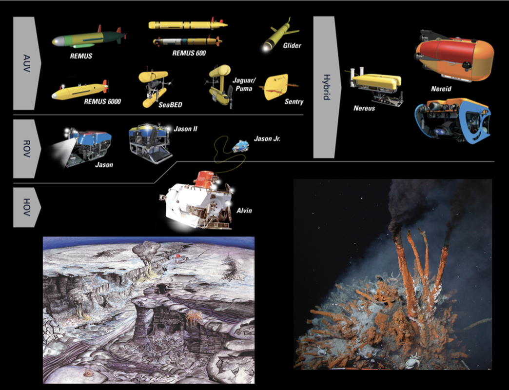
Image from D. Fornari (WHOI)
|

Flyer
|
